History of Google Street View / Rwanda

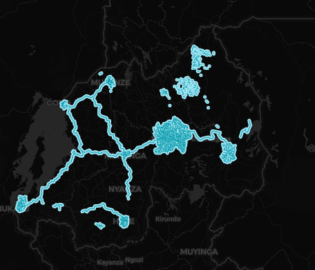
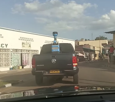
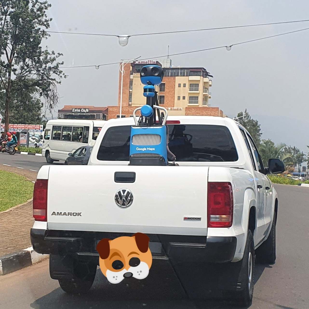
In November 2021, Google Africa officially integrated Rwanda into the Street View service in collaboration with the Ministry of ICT and Innovation.[1] In August 2022, it was confirmed that a car equipped with a Gen 4 Trekker was photographing various parts of the city of Kigali.[2]
In October 2022, Google published the first images in some suburbs in Central Kigali.[3] In November 2023, Google published the first images around the city of Butare in the Southern Province.[4]
In December 2023, Google published coverage in cities located on the shores of Lake Kivu such as Gisenyi and Cyangugu in Western Province, in addition to Byumba in Nothern Province.[5] In early February 2024, Google finally released coverage in the cities of Ruhengeri in the Northern Province and Muhanga in the Southern Province, in addition the town of Kabarondo in Kayonza District, Eastern Province.[6]
In May 2024, the Rwanda Cultural Heritage Academy collaborated with Google Arts and Culture to provide street views of various historical and cultural sites in Rwanda, including published coverage done with trekkers on various trails in the Buhanga Ecological Park in the Northern Province.[7]
In addition, Google Street View vehicles drove along some of the main roads and trails of several nature reserves in Rwanda such as Akagera National Park and Nyungwe Forest National Park.[8] Also the Google Maps team in Rwanda added some routes around Volcanoes National Park.
At the end of October 2024, the Google Maps team in Rwanda confirmed the addition of the city of Rwamagana, capital of the Eastern Province. Subsequently the coverage was greatly expanded in this region, notably the Lake Muhazi area.
History
Note: We take into account the date when the coverage was taken, not the date when it was published.
| Year | Additions |
| 2022 |
|
| 2023 |
|
| 2024 |
|
Gen 4 Cameras
Note: Credits to Mapper and xdTAGCLAN for finding the images of the Gen 4 Pickup
External Resources
- Rwanda at Google Arts and Culture
References
@googleafrica (2021-11-17) "Yesterday we joined the @RwandaICT to announce new plans towards training and upskilling developers and digital ambassadors, piloting a fintech incubation program, supporting SMBs to go online, bringing Rwanda on Street View & others." via Twitter
Baptenda (2022-08-11) "Good News! It is confirmed #Rwanda will get an official #GoogleStreetView coverage." via Twitter
Favour, E. (2022-10-22) "Google Street View comes to Rwanda’s streets" The New Times
"Today new #GoogleStreetView imagery has been released in #Rwanda. 6 small areas in Kigali, Butare, Kibeho and the Nyungwe Forest NP are covered" (2023-11-07) VirtualStreets via Twitter
Mapper (2023-12-15) "New Google Street View update released in Finland, Kenya, Poland, Rwanda and Senegal" VirtualStreets
ReAnna "Google Street View Coverage Map of February 2024" SV-Map
"Thrilled to announce the launch of #Rwanda's cultural heritage collection on the Google Arts & Culture platform!" Inteko y'Umuco via Twitter
Ndayisaba, B. "Another @googlemaps Street View available for Rwanda in the East. @AkageraPark" (2023-11-10) via Twitter
Ndayisaba, B. "Finally the city of Rwamagana is fully covered by Google Street View. Check out this link where to see the nice office of @RwamaganaDistr @RwandaEast @PudenceR" (2024-10-29) via Twitter


