History of Google Street View / Puerto Rico

(Source: SV-Map)
In early 2016, Google sent several trekkers to introduce Puerto Rico to Street View starting with several historical and tourist areas of the City of San Juan.[1] The Google team on the island covered mainly the San Juan metropolitan area in addition to the urban areas of Ponce, Caguas, Guayama, Aguadilla, Mayagüez and Fajardo.[2]
In late 2016, Google officially launched coverage in Puerto Rico and US Virgin Islands.[3] The Street View project was supported by several nature conversation organizations to photograph nature reserves around the island such as the Jobos Bay Estuarine Research Nature Reserve (Spanish: Reserva Natural de Investigación Estuarina de Bahía de Jobos) in the Municipality of Salinas.[4]

Additionally Google photographed several sites using trekkers in the city of Mayagüez such as the University of Puerto Rico Campus as well as the City Zoo, these panoramic images were taken in April 2016. With respect to other cities, Google also added views of several Carolina museums and historical sites including the Los Gigantes Gallery as well as the Children's Museum (Spanish: Museo del Niño de Carolina), these tripod views were made in late 2016.[5]
The project was supported by Marie Laborde, representative of the Puerto Rico Tourism Company, as well as Giovanni Stella, General Manager of Google for Colombia, Central America and the Caribbean.[6] In addition, the Google Street View team also photographed with trekkers some of the emblematic fortresses and castles of Old San Juan including the Santa Catalina Palace/La Fortaleza, San Cristóbal Castle, Cuartel de Ballajá.[7]
Coverage Expansion
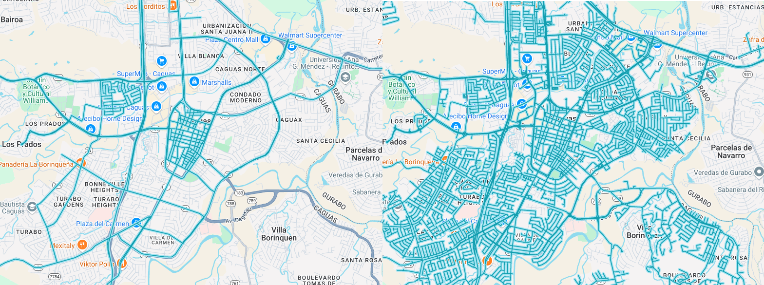
At the end of October 2024, Google started to cover again part of the island using handheld cameras, the coverage focused mainly around the city of Caguas and later began to extend to other nearby cities. In mid-December 2024, Google teams began to update coverage around the Historic Center of San Juan.
Additionally in the same month, Google Street View teams began photographing part of the PR-988 that runs through the northern part of Yunque National Park.
History
Note: We take into account the date when the coverage was taken, not the date when it was published.
Source: Puerto Rico's Coverage Dates - Emily Geo Website
| Year | Additions |
|---|---|
| 2016 |
|
| 2024 |
|
Gallery
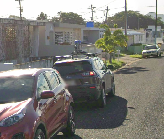
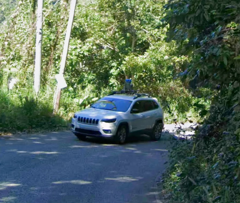
Trekkers


Gen 3 Cameras


Gen 4 Cameras
Resources
- Puerto Rico on Google Arts and Culture
References
Vargas, W. (2016-01-25) "Ya comenzó el proceso de "Street View" de Google en Puerto Rico...y tenemos las fotos que lo prueba" Tecnético (in Spanish)
Vargas, W. (2016-12-15) "Estos son los pueblos de Puerto Rico por los cuales “Street View” pasó y no paró" Tecnético (in Spanish)
Whitehead, T. (2016-12-16) "Street View comes to Puerto Rico and the US Virgin Islands" Google Earth Blog
"Fotografiando las veredas de JBNERR con el señor José Santos de Google Earth, para incorporarlas al banco de imagenes de street view." (2016-04-04) Reserva de Investigacion Estuarina Bahia de Jobos-JBNERR via Facebook (in Spanish)
Soto, M. (2016-12-13) "Desde hoy podrán acceder a vistas 360° de P. R. en Street View de Google" Metro Puerto Rico (in Spanish)
"Puerto Rico se podrá ver en 360 grados en Google Street View (vídeo)" (2016-12-13) Noticel (in Spanish)
"Google Street View y Special Collects disponibles en Puerto Rico" (2016-12-14) Qiibo (in Spanish)


