History of Google Street View / Bhutan
(Source: SV-Map)
In March 2013, Google together with the Ministry of Information and Communications of Bhutan announced about the filming of several cities in the country to promote tourism globally.[1]
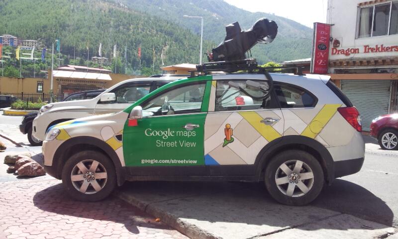
The coverage was done with vehicles that were originally going to be used to cover India, the team at South Asia covered several roads around Buddhist temples and monasteries around Bhutan including Rinpung Dzong (Dzongkha: རིན་སྤུང་རྫོང་།) in Paro, the National Memorial Chhorten (Dzongkha: རྒྱལ་ཡོངས་རྗེས་དྲན་མཆོད་རྟེན།) in Thimphu, Trongsa Dzong (Dzongkha: ཀྲོང་གསར་རྫོང།) in Trongsa.[2]
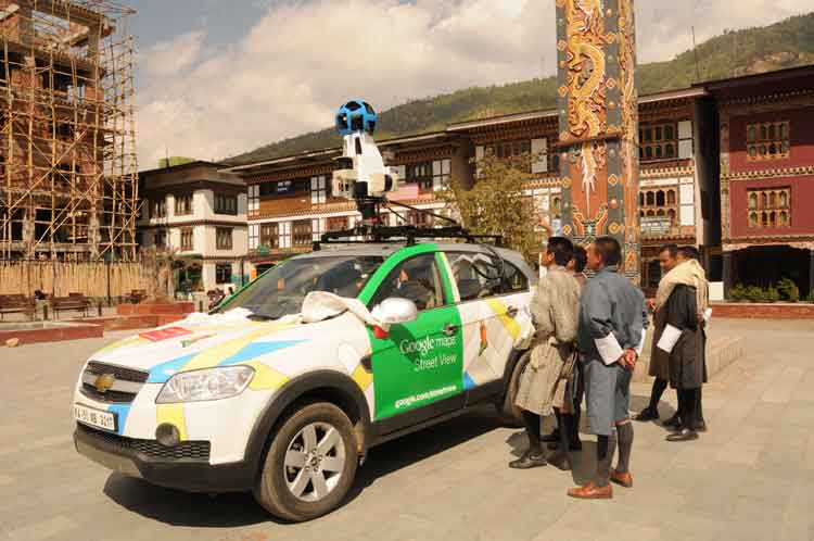
In late 2014, Chhimmy Pem, former director of the Bhutan Department of Tourism, along with Google representatives announced the country's addition to the service.[3] Among the company representatives who were in charge of promoting the project to the Bhutanese market was Stephanie Shih where several demonstrations of the 360 images were held in Thimphu at the end of October 2014.[4]
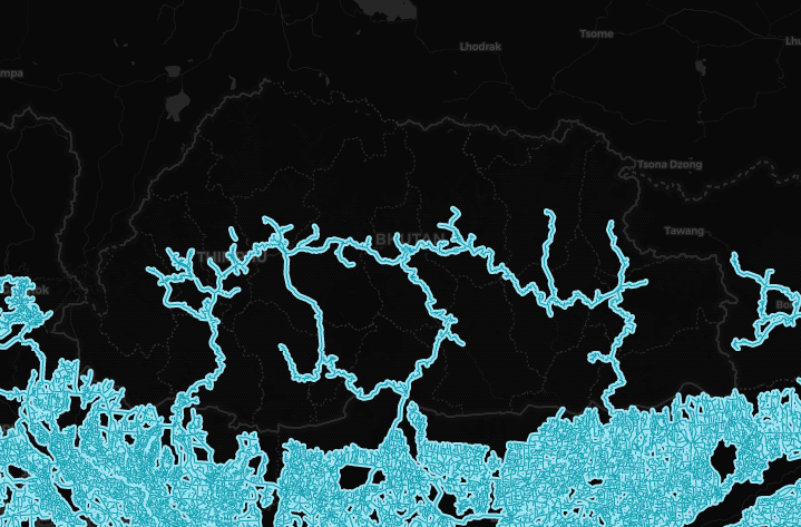
According to Google statistics, approximately 3,000 kilometers of roads around the country were covered. One of the reasons why the project was approved in the country was to be able to properly digitize historical sites and scenic roads in the mountains without having to affect the environment after the negative effects of mass tourism.[5] In addition, the government agency Tourism Bhutan partially promoted the project on social media, highlighting views taken in the Ura Valley in Bumthang District.[6]
Coverage Expansion
Wangdue Phodrang Dzongkhag
Between May 25 and 26, the Google Maps team began photographing locations around the Phobjikha Valley including the Lamazhuthri - Tongchey Road characterized by passing around several archaeological ruins in addition to Ngenlung Drechagling Lhakhang.
Bumthang Dzongkhag
On June 9, 2013, the Google Maps team arrived at Tang Gewog, where they photographed the area around Guru Nangsid Zilnon Phodrang, a Buddhist temple. Subsequently on June 27, 2013, the Google Maps team covered the road that connects to the Tharpaling Monastery located in the Chhume Gewog, which reaches an altitude of over 3500 meters.
History
Note: We take into account the date when the coverage was taken, not the date when it was published.
Source: Bhutan's Coverage Dates - Emily Geo Website
| Year | Additions |
|---|---|
| 2013 |
|
Gallery
Gen 3 Cameras


References
"ལྟ་བཤལ་གོང་འཕེལ་གྱི་དོན་ལུ་ བརྡ་དོན་འཕྲུལ་རིག་གསརཔ།" (2013-03-15) [Translation: New Informative Technology for Tourism Development] Kuensel Dzongkha Online (in Dzongkha)
Brown, I. (2015-01-15) "The Kingdom of Bhutan" Google Sightseeing
Pen, C. (2014-10-23) "Google street view for Bhutan launched today. Try some virtual travel." via Twitter
"Google product communications manager Stephanie Shih demonstrates a Google Street View of Thimphu, on October 23, 2014" (2014-10-25) via Facebook
Dorji, D. (2014-10-27) "Why Bhutan went on Street View" Google The Keyword
@tourismbhutan (2014-10-23) "Check out Ura valley in Bumthang on google #street #view @Chhimmy @theBhutanese #happiness #Bhutan" via Twitter


